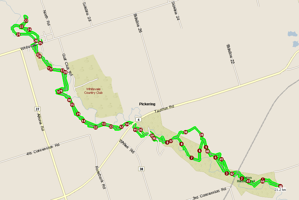
The distance on the Garmin says "18.4km Total Run Distance", but when I plug the .xml into MapPoint it says the total distance covered is actually 21km+. While I think that the Garmin "lost" some distance, I think that MP has added extra distance due to tangents added due to loss of signal. I don't think that the run could have been more than 20km, having been run in less than 2 hours and the first hour's average speed being around 7:20/km.
Hit The Road was founded in 2004 by Tony Denford to provide fitness and running training to individuals, corporations and charities. Since that time, we have evolved to provide wellness programs and education to corporate clients to help them become the employers of choice while improving their bottom line and the lives of their employees.For more information on our services, please contact info@hittheroadrunning.com.

3 comments:
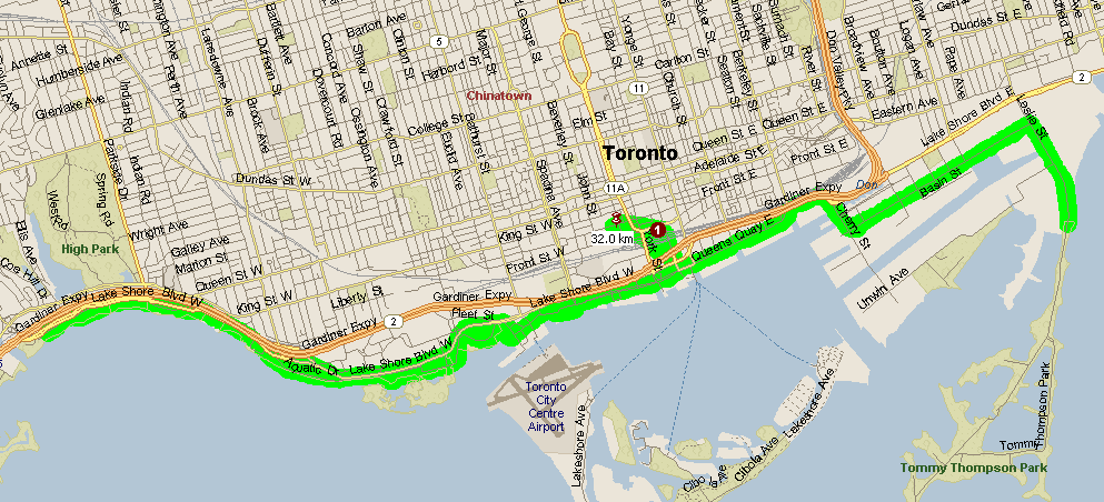
What's the distance of the trail run?
Whoa, Ken, you went FAR.
I must say that it felt much farther that it really was.
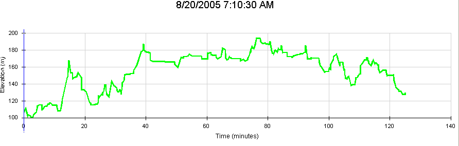
And as always, the elevation profile is a joy to see. Thanks.
The distance on the Garmin says "18.4km Total Run Distance", but when I plug the .xml into MapPoint it says the total distance covered is actually 21km+. While I think that the Garmin "lost" some distance, I think that MP has added extra distance due to tangents added due to loss of signal. I don't think that the run could have been more than 20km, having been run in less than 2 hours and the first hour's average speed being around 7:20/km.
Post a Comment