
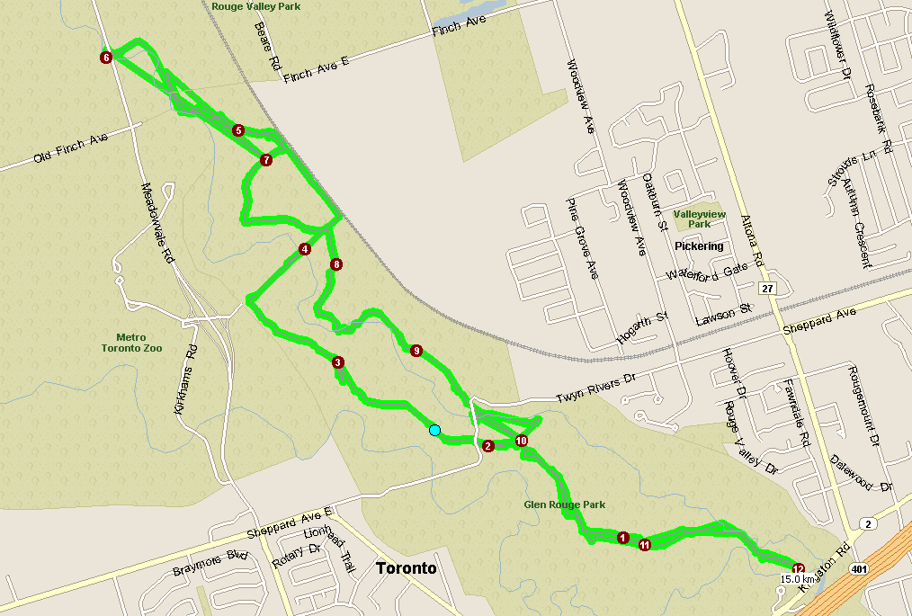
This map says we did 15 km on Saturday, but I think that is because of the amount of lost signal at the top end of it. That part of the run didn't look like that.
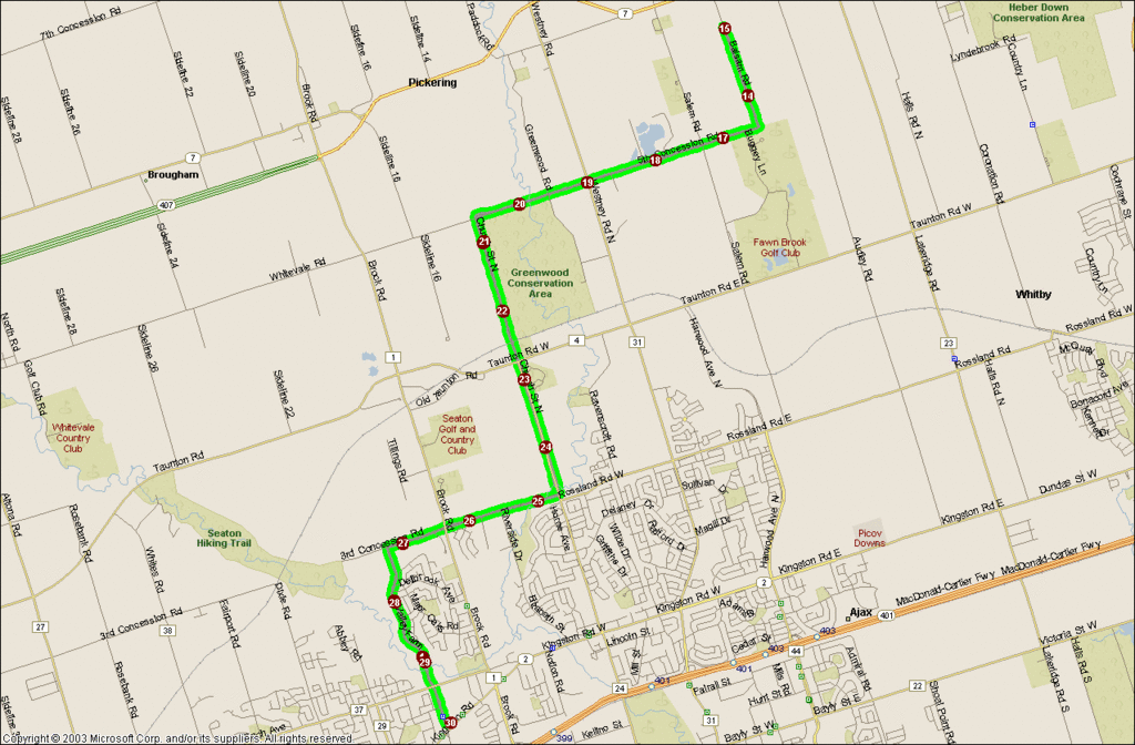
For those who ventured out for 30km on the road. That sure is a long way. What are the houses going for up there in Brooklin? Thanks to Chuck for the map!
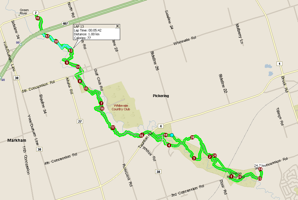
I think that this map is pretty accurate, Map Point adds in distance for elevation. I don't think that the Forerunner adds that in. It is more of a Point to Point type of thing. It doesn't look like I lost much signal on this run.
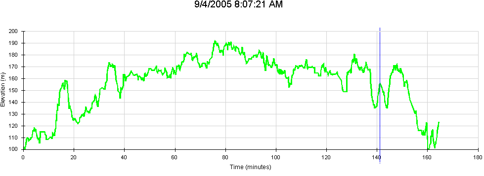
Check out the elevation! The Blue line is the extra little "Hill" that I went up, where everyone else went around the easy way. Chickens- "buk-buk-buk"
No comments:
Post a Comment